By Philippe Reclus
summary
The article examines how the management of limited natural resources can be organized and improved by leveraging space-based observations, data, and analytics. By integrating satellite imagery, remote sensing, GIS, and related workflows with ground-level datasets (soil properties, rainfall, water quality, land use, infrastructure), decision-makers can generate timely, scalable insights to support land, water, fisheries, minerals, and other resources. This space-enabled approach is presented as capable of enhancing inventory, monitoring, planning, and governance, while informing indicators, targets, and evidence-based policy across sectors. Why space matters is framed around its ability to provide synoptic, near-real-time views of ecological and resource conditions that are hard to obtain at scale from the ground alone. The lead highlights how space-derived products (when fused with field data) can improve transparency, accountability, and efficiency in planning, licensing, and enforcement, including in fisheries and other extractive sectors. It also notes governance challenges and the need for robust data architectures, standardized practices, and inclusive stakeholder engagement to translate observations into actionable management decisions. The article foregrounds a practical, end-to-end framework for space-enabled governance, including data stewardship, repeatable workflows, and performance indicators that reflect ecological and social objectives. It discusses system architecture, capacity-building, and cross-border collaboration as essential to scalable impact, while acknowledging ethical, privacy, and security concerns that accompany pervasive observation and data sharing. Early case studies and future directions illustrate how space-enabled approaches can support transboundary water cooperation, drought and flood risk management, and sustainable land-use planning, with emphasis on integrating technology, policy instruments, and community participation. The lead notes ongoing debates about data access, equity, and legitimacy in New Space governance, and signals the potential for evolving missions, open data, and AI-assisted decision support to shape resource stewardship in the years ahead.
Overview
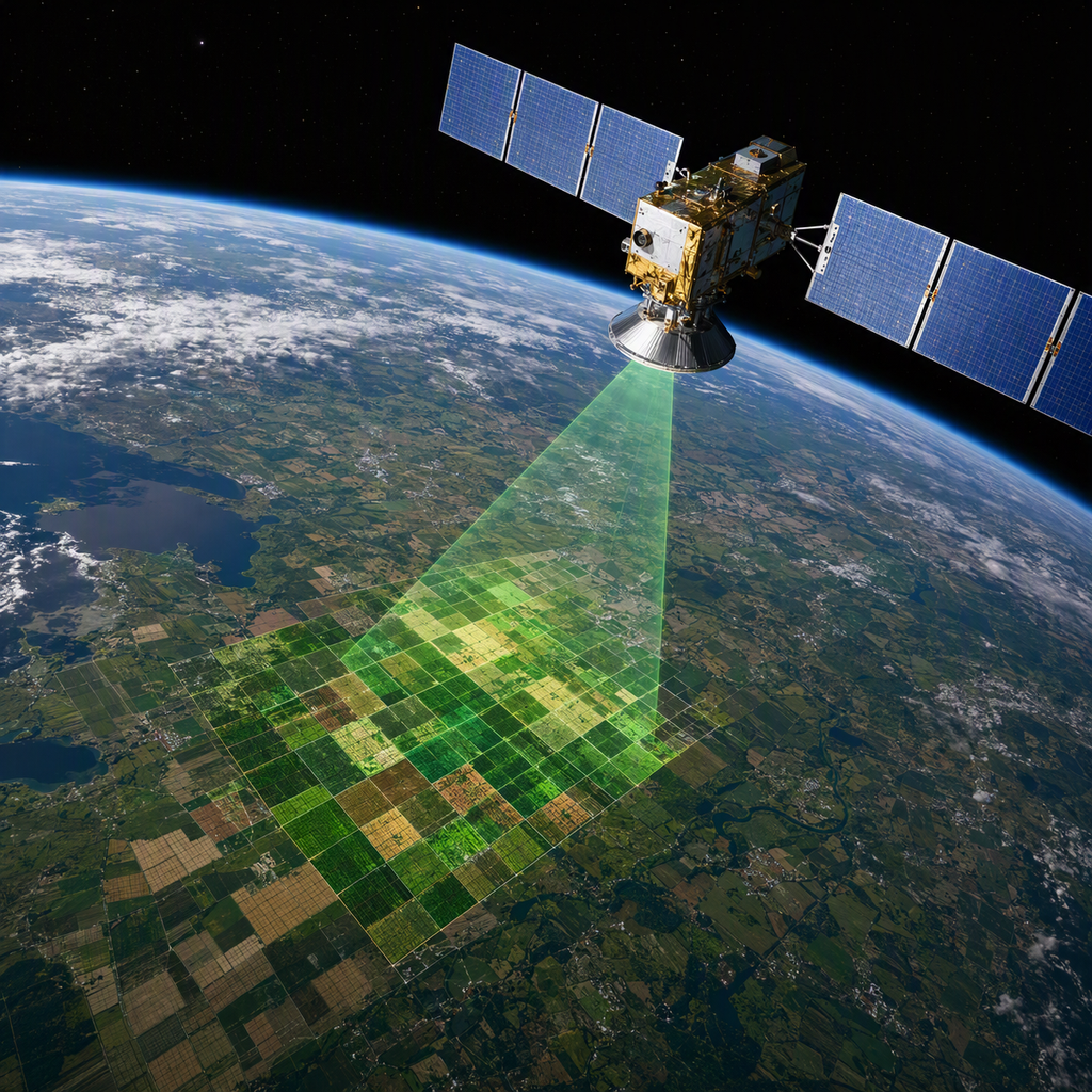
The management of limited natural resources can be significantly improved through space-enabled data and analytics that support detection, analysis, planning, and delivery of sustainable use strategies. Space-derived information (derived from remote sensing, geographic information systems (GIS), and related analytical workflows) provides timely, land- and resource-covering insights that are otherwise difficult to obtain at scale. By integrating satellite imagery with collateral field data (soil properties, rainfall, water quality, land use, and infrastructure), policymakers and managers can generate actionable maps, statistics, and reports to guide decision making for land, water, fisheries, minerals, and other natural resources. A practical workflow often begins with acquisition of satellite data (for example, multi-season optical sensors) and the collection of supporting datasets such as soils, lithology, rainfall, and village-level land use. Subsequent digital image processing, georeferencing, and mosaicking enable the production of thematic layers that can be integrated in a GIS framework. The resulting products support land capability assessments, resource inventories, and monitoring programs, helping to balance competing demands for land, water, and other resources while considering ecological, social, and economic objectives. Space-enabled monitoring and analysis also intersect with governance and management processes. Effective resource management requires aligning monitoring activities with licensing, planning, and policy formulation; ensuring compliance; and embedding monitoring within legal and institutional frameworks to achieve legitimacy and cost-effectiveness. In fisheries and other extractive sectors, monitoring, control, and surveillance concepts (supported by space-based data) can improve the efficiency and reach of enforcement, as well as the documentation and verification of conservation measures and catch statistics. Across sectors, adopting a space-enabled, information-rich approach supports transparency, accountability, and evidence-based decision-making, including the setting of objectives, indicators, and reference points that reflect ecological limits and societal needs. Beyond practical mapping and monitoring, space-based methods can contribute to long-term strategic planning under rapid demographic and climatic change. The literature emphasizes the need for integrated analyses that combine remote sensing with field data to assess land productivity, erosion, salinity, waterlogging, and other degradation processes, thereby informing judicious land use and rehabilitation efforts. In this broader governance context, an SDRS-like framework of criteria and indicators (spanning economic, social, ecological, and governance dimensions) helps articulate shared objectives and measurement targets for sustainable resource management, while clarifying trade-offs and enhancing stakeholder engagement.
Background
The management of limited natural resources can be significantly enhanced by leveraging space-based observations that provide real-time or near-real-time insights into ecological conditions. The Water Stress Index, for example, offers a precise and timely measure of crop stress, enabling irrigation issues to be detected before they affect yields, and uses peak daylight imagery and multispectral sensing to identify early indicators of crop health. Such remote sensing approaches rely on geo-referenced imagery and data processing that isolates canopy information from ground cover and background noise, improving the accuracy of assessments and supporting crop-specific management decisions. Beyond image capture, the interpretation of remote-sensing data must account for atmospheric and surface variables that influence reflectance and visibility. Differences in soil moisture, surface roughness, organic matter, and mineral content can alter optical signals, while atmospheric components such as aerosols and haze affect image contrast and color representation; understanding these factors is essential for robust land-use and resource management analyses. In practice, this involves modeling and correction steps to separate genuine biophysical signals from distortions caused by the atmosphere, surface texture, and illumination conditions, thereby enabling more reliable assessments of resource status across space and time. Effective resource management also benefits from integrating space-enabled monitoring within comprehensive governance frameworks. In fisheries and aquatic-resource contexts, integrated approaches such as Integrated Fish Management Plans (IFMPs) and the Integrated Conservation and Management System (ICAMS) emphasize the allocation of responsibility and accountability for monitoring to industry stakeholders while retaining regulatory oversight to ensure conservation and socioeconomic objectives are met. The alignment of monitoring, management procedures, and evaluation criteria (hallmarks of frameworks like ICAMS and HACCP-like approaches) helps translate space-derived information into actionable policies, performance measures, and adaptive management practices. This holistic view supports the shift from traditional reactive enforcement toward proactive, data-informed decision-making that can better steward limited resources in a multi-use environment.
Space-Based Capabilities for Monitoring and Decision Support
Space-based information and services provide a comprehensive, synoptic view of natural resources that supports inventory, monitoring, and decision making across sectors such as agriculture, hydrology, forest management, and environmental protection. Remote sensing and space-derived analysis offer valuable input for sustainable development goals and post-2015 development agenda planning, enabling timely assessments, change detection, and scenario analysis that are difficult to achieve with ground-based data alone.
Key applications for resource management
- Transboundary water management and cooperation: Space technologies support monitoring of dam and reservoir operations, river discharge, aquifer dynamics, and water quality, facilitating continuous and reliable data exchange among riparian states. This improves the balance between water use and conservation, supporting sustainable development in shared basins.
- River flow and groundwater management: Earth observation (EO) data provide diverse datasets from satellites such as Landsat, Sentinel, GRACE-FO, and VIIRS, offering different spatial and temporal resolutions essential for tracking hydrological variables and aquifer status over time. The broad suite of spaceborne sensors enhances the ability to monitor water resources across large and remote landscapes.
- Water quality monitoring: Accurate, large-scale water quality assessments are critical for downstream populations and ecosystems. Space-based observations contribute to monitoring indicators such as temperature, chlorophyll content, turbidity, and other chemical and physical parameters, supporting water safety and ecosystem health.
- Forest and land resources management: Space-derived information supports forest monitoring, vitality assessments, and species identification, aiding sustainable forest management, biodiversity conservation, and planning in urban, agricultural, and rural contexts.
- Air quality and emissions estimation: Satellite-derived air quality models provide high-resolution maps of urban and regional pollutant distributions, assisting stakeholders in evaluating exposure, health risks, and mitigation effectiveness.
Data, methods, and integration
- Space-based data come from a variety of missions and sensors, enabling analysis across multiple scales and timeframes. The availability of Landsat, Sentinel, GRACE-FO, VIIRS, and other datasets allows users to tailor observations to specific management questions (from short-term emergency planning to long-term resource planning) while linking environmental changes to policy and socio-economic contexts.
- Data management and information systems play a crucial role in organizing, storing, and processing vast geospatial and temporal datasets. Understanding data structures (such as relational, hierarchical, or network models) helps optimize storage, retrieval, and analysis workflows for resource monitoring projects, ensuring efficient extraction of actionable insights.
- Capacity building and knowledge exchange are essential components of leveraging space-based capabilities. Regional education centers and UN-affiliated programs provide training and exchange of best practices, enabling developing countries to adopt space-based solutions for natural resource management and environmental planning.
Benefits for decision making
- Enhanced situational awareness: Space-based observations deliver near-global coverage with repeated passes, enabling timely detection of environmental changes, disasters, and resource depletion, which supports proactive management actions.
- Improved collaboration and governance: Regular data sharing on transboundary resources fosters trust and cooperative planning among neighboring jurisdictions, reducing data gaps and facilitating joint mitigation and adaptation strategies.
- Efficient allocation of resources: By reducing the need for costly field campaigns and enabling scalable monitoring, space-based information helps allocate investments where they yield the greatest benefit for ecosystems, communities, and economies.
Organization and Governance Models
Organizing natural resource management around space-enabled information platforms benefits from repeatable governance workflows, standardized data practices, and clear accountability structures. Regular and systematic inventory of natural resources enables monitoring of changes, prioritization of corrective actions, and timely strategic planning, as well as the investigation of dynamic ecological processes over time. Governance models for space-enabled resource management often combine centralized policy direction with cross-functional execution teams. The National Resource Governance Institute (NRGI) offers an illustrative example of multidisciplinary leadership and program delivery, spanning governance, economics, law, and operations, organized into leadership, program, and regional directorates as well as specialized functional teams. This structure highlights the value of clearly delineated roles such as senior program leadership, regional directors, and functional leads (e.g., legal, economics, capacity development, communications, and operations) to coordinate complex initiatives. Data governance and technical architecture are central to leveraging space-based information. A robust approach involves building a data repository that integrates diverse data types (spatial and non-spatial) while differentiating data, information, and knowledge. The process includes standardizing data inputs, assigning weights to layers for capability classification, and applying a GIS/remote sensing workflow to support decision-making. Regular Earth observation data collection, coupled with geospatial analysis, underpins ongoing monitoring of vegetation dynamics, resource stocks, and environmental conditions, enabling timely management responses. Capacity development and training are essential to ensure technical staff can map, analyze, and interpret spatial data using GIS and remote sensing tools, thereby improving mapping, monitoring, and sustainable resource management capabilities. Governance should also embed strong internal controls, financial accountability, and donor compliance. Effective organizational governance includes developing and updating policies and procedures, maintaining anti-fraud and whistleblower mechanisms, ensuring procurement transparency, and aligning with applicable legal and regulatory requirements. Building donor compliance and risk-management capability across teams, coordinating audits, and capturing lessons learned are key elements of a resilient governance model. In sector-specific contexts, governance models must be integrated with management frameworks to enable enforcement and compliance. For example, fisheries monitoring and enforcement should be embedded within broader fisheries management and marine resource stewardship. A successful approach requires measuring activities, assigning responsibility to members of the fishing enterprise for monitoring conservation measures, and aligning enforcement with the measured data to achieve compliance. This model emphasizes that “If you can’t measure it, you can’t manage it,” and it relies on integrating information collection, reporting, and incentives within the management system to improve compliance and effectiveness.
- A clear governance structure with defined leadership and cross-functional teams, as demonstrated by NRGI’s leadership and programmatic organization.
- A robust data governance framework, standardized data practices, and GIS/remote-sensing capabilities to collect, integrate, and analyze spatial and non-spatial information.
- Strong internal controls, procurement and compliance management, and donor risk capabilities to support transparent and accountable operations.
- Integrated sector management where monitoring and enforcement are aligned with the overarching management objectives and measurable indicators, such as fisheries or other resource sectors.
System Architecture for Leveraging Space
The system architecture for leveraging space in the management of limited natural resources is anchored in a mission-driven, multi-stakeholder framework that prioritizes operationalization of space technologies within regional programmes. It emphasizes enabling space-enabled services for natural resource management, environmental monitoring, and disaster management, particularly in Africa and Western Asia, while fostering collaboration with UN agencies and regional centres for training and implementation. This architecture seeks to translate research and capability development into actionable pilot projects and scalable operations, aligning with broader international agendas such as the UN Millennium Declaration and related implementation plans. A central component of the architecture is the integration of space-enabled designs and applications to support governance and public service delivery. The Space Enabled research group articulates a mission to advance justice in Earth’s complex systems by collaborating with development leaders across multilateral organizations, governments, and the private sector to identify opportunities for space technology to improve public services and address local challenges. This emphasis on just and equitable application informs system requirements, including accessibility, affordability, and relevance to diverse communities. Data governance and interoperability form the backbone of the architecture. Integrated data governance enables real-time visibility into data health, lineage, usage, and access controls, supporting alerts and remediation as needed to maintain data reliability across the system. Such governance is essential for coordinating data streams from space-based sensors with terrestrial datasets, ensuring that decision-makers can rely on consistent, auditable information. Remote-sensing capabilities underpin the monitoring and planning functions of the system. For example, accurate river-flow monitoring using satellite-derived measurements such as SWOT and GRACE-FO supports transboundary water management, agricultural planning, and urban water use. The architecture must therefore accommodate continuous data streams, sensor heterogeneity, and real-time or near-real-time processing to inform operational decisions and long-term planning. In addition, outputs from satellite-derived datasets can inform dam management and lifecycle optimization, enabling informed decisions on infrastructure lifespan and efficiency. To ensure reliability and scalability, the architecture adopts repeatable governance workflows that enhance access control, data quality, compliance, lifecycle management, and the application of AI where appropriate. Such workflows standardize how data are curated, shared, and utilized across agencies and partners, reducing duplication and accelerating translation from data to action. Finally, an effective system architecture incorporates a robust framework for indicators and decision support grounded in risk management and sustainable development objectives. Indicators and reference points should be scientifically valid, feasible, and communicable to stakeholders, with explicit consideration of data availability, cost, and practicality. A structured process for selecting indicators (including defining objectives, building conceptual models, identifying data needs, and documenting methods) facilitates coherent performance assessment and decision-making within the SDRS framework. The architecture thus integrates risk assessment, response planning, and governance processes to support adaptive, evidence-based management of shared natural resources in a space-enabled context.
Applications by Resource Type
Soil Resources
Remote sensing and GIS techniques are applied to mapping and monitoring soil resources to support soil surveys and soil capability classification. These methods enable grouping soils into capability units, subclasses, and classes based on factors such as texture, structure, drainage, salinity, and organic matter, thereby informing management decisions and land-use planning. Soil surveys, historically conducted as National Cooperative efforts, leverage spatial soil data to understand soil distribution, properties, and potential crop responses, facilitating informed interventions in degraded or stressed environments.
Water Resources
In arid and semi-arid regions where perennial rivers are scarce, remote sensing and geospatial analysis aid in planning for future water demand, reduction of reservoir losses, rainwater harvesting, and the selection of crop varieties with lower water requirements. These applications support policymakers and water managers in anticipating shifts due to climate change and in allocating limited water resources more efficiently, particularly in desert margins and drought-prone landscapes.
Vegetation, Fodder, and Biomass Resources
Geospatial analysis supports the evaluation of vegetation cover, biomass availability, and fodder resources for rural livelihoods. Integrated vegetation maps, village-level data, and socio-economic indicators are used to estimate available biomass, fuelwood, and fodder requirements, enabling assessment of surpluses or deficits at the village level and guiding management of grazing and exploitation of woody resources. Remote sensing-derived vegetation indices and thematic maps facilitate rapid assessment of vegetation health, productivity, and land cover change over time, contributing to sustainable resource planning.
Land Use Planning and Resource Monitoring
Remote sensing and GIS methodologies are used to monitor natural resources, assess land use conflicts, and support sustainable, multi-functional landscape planning. These tools are employed to map land cover, land capability, and environmental constraints, aiding decision-makers in balancing agricultural production, conservation, and development needs. The integration of geomorphological maps, drainage patterns, and soil-geomorphology relationships provides a comprehensive basis for forecasting land degradation pathways, erosion risk, and water-logging potential, thereby informing land-use zoning and resource allocation.
Geomorphology, Soils, and Resource Survey Integration
A combined approach of geomorphological mapping and soil resource assessment supports a holistic understanding of how landscape processes influence soil formation, hydrology, and resource availability. Historical and modern mapping efforts (spanning coterminous geomorphology, soil surveys, and land capability classifications) provide essential context for soil resource management, erosion control, and sustainable cultivation in diverse terrains (e.g., dune fields, saline soils, and hard-pan areas).
Economic, Social, and Capacity Considerations
Effective management of limited natural resources through space-based approaches requires integrating economic viability, social equity, and long-term capacity development. Economically, sustained investment in data, monitoring, and infrastructure is essential to turn space-derived information into actionable decisions. International and national commitments have increasingly directed funds toward public-private partnerships and capacity-building initiatives that expand the availability of high-quality, timely, and reliable data, including disaggregated indicators essential for informed resource planning. These investments aim to support the development of statistical capacity and the creation of national plans that are fully funded and implemented, as well as the measurement of progress on sustainable development beyond traditional gross domestic product metrics. In addition, international partners emphasize multi-year funding and technology transfer to ensure that capacity building becomes institutionalized and resilient, particularly in lower-income countries and at local levels. Socially, space-enabled resource management must address equity and inclusion to ensure that benefits and alerts reach all population segments. Language accessibility, gender considerations, disability, age, ethnicity, and geographic disparities influence how warning systems, data products, and land-use decisions are perceived and acted upon. To avoid marginalizing vulnerable groups, capacity-building programs stress multilingual and culturally appropriate communication strategies, with explicit attention to equity in both information dissemination and decision-making processes. This includes maintaining non-digital channels of communication and ensuring targeted support for women, elderly individuals, persons with disabilities, ethnic minorities, migrants, and low-income populations, so that disaster risk reduction and resource management are inclusive and effective. The emphasis on data disaggregation and inclusive governance aligns with broader efforts to develop measurements of progress on sustainable development that complement GDP, thereby enabling more nuanced social indicators to guide environmental decision-making. From a capacity perspective, successful land-use and resource management relying on space-based data hinges on strengthening technical skills, institutional capabilities, and sustainable financing. International guidance highlights four levels of capacity-building: technical skills training for early warning and data personnel; institutional strengthening through standard operating procedures and organizational development; technology transfer with a focus on sustainability and local maintenance; and infrastructure upgrades, including monitoring networks and communication systems. This multi-faceted approach should prioritize long-term, multi-year investments and foster regional cooperation, including South-South collaboration, to build self-reliant systems that can operate independently of external assistance. Effective management also requires integrating diverse data sources and ensuring data are standardized and interoperable, so that land-use plans and resource assessments can be iteratively refined as new space-based observations become available. In practice, this means combining remotely sensed data with ground truth, local knowledge, and economic considerations to support robust, sustainable decision-making in landscape planning and natural-resource allocation.
Security, Privacy, and Ethical Issues
The use of space-derived data and remote sensing for managing limited natural resources raises diverse security, privacy, and ethical concerns that must be addressed to ensure responsible governance. Researchers and authorities should weigh potential harms and implement safeguards before publishing findings or acting on insights. For example, privacy considerations arise from satellite imagery and other remote-sensing data that could inadvertently reveal individuals or vessel locations, particularly in conflict zones or disputed waters. Deliberations about whether and how to disclose such information are important to prevent harm to civilians, informants, or at-risk communities. Data interpretation in space-enabled monitoring can introduce biases that disproportionately affect indigenous communities and traditional rights holders. Apparent fishing or resource-use patterns near Marine Protected Areas (MPAs) may reflect legitimate or regulated activities rather than illegal misuse, and interpretations can be complicated by legal, cultural, and governance contexts. Debates surrounding the establishment of MPAs (such as inadequate consultation with indigenous groups and potential impacts on customary fishing rights) underscore the need for cautious, context-aware analyses. Access, interoperability, and governance pose additional ethical and security questions. The ways in which access arrangements with external partners or international bodies are structured can influence perceptions of interdependence with financial or infrastructural support. It is important to clarify that access for monitoring or resource management does not imply disguised conditionality, and to ensure that obligations under international law for resource conservation and domestic food security remain transparent. Operational security and data integrity are central to trustworthy space-based monitoring. Some constraints can be mitigated by regulatory and procedural measures, such as more frequent position reporting, data-sharing requirements for foreign-flagged vessels, and common standards to improve interoperability. Yet deliberate tampering with vessel monitoring systems (VMS) or disabling transmissions remains a risk. In many jurisdictions, tampering or deactivation is prohibited and may constitute serious violations, with gaps in transmissions flagged by monitoring systems for follow-up. Unauthorized access or circumvention of monitoring tools calls for robust sanctions and cross-jurisdictional cooperation among flag, port, and coastal states. Ethical stewardship also entails ensuring data reliability, accuracy, and inclusivity. The collected and processed spatial data should be shareable, reliable, secure, correct, consistent, complete, independent, and free from excessive redundancy to support equitable governance across stakeholders. As technology enables wide-scale monitoring, continuous attention to data quality and governance standards is essential to prevent misuse, misinterpretation, and unequal impacts on marginalized communities. The deployment of advanced tools such as satellite imagery, GIS-based risk mapping, and real-time monitoring also presents governance challenges in terms of privacy and rights. While satellite-based risk assessments and hazard monitoring support proactive policy-making, they require careful balancing of public interest with individual and community privacy, especially when identifying sensitive sites or vulnerable populations. In addition, the integration of various data streams (ranging from AIS/VMS signals to remote sensing) should be complemented by transparent, accountable regulatory frameworks to safeguard governance integrity and public trust. To maximize benefits while minimizing harms, policy-makers and researchers should adopt accountable practices: clearly delineating what is observed and published, ensuring informed consent or community assent where applicable, applying non-discriminatory methodologies, and maintaining open channels for scrutiny and redress. The ongoing dialogue around the use of space-based data for resource management must foreground ethical principles, privacy protections, and equitable outcomes for all stakeholders.
Challenges and Limitations
Enforcement and jurisdiction present initial constraints for leveraging space-based resources in managing limited natural resources. Some offences linked to IUU fishing or cross-border resource exploitation may fall under jurisdictions where acts committed beyond national waters are deemed to occur within a coastal state’s territory or the flag state’s competence, complicating cooperation and sanctions. Even when a flag state has regulations aligned with its international obligations, international cooperation can require that the alleged conduct abroad also constitutes an offence in the state from which cooperation is sought, potentially limiting mutual assistance such as information exchange, asset seizures, or extradition if essential offences are not recognized domestically. Harmonisation of rules across neighboring states with different legal traditions remains a significant challenge, though it is deemed feasible given shared objectives and the common technical framework of instruments like the IPOA IUU and UNCLOS obligations. Achieving harmonised authorisation schemes, technical standards for vessels and equipment, permitted activities, reporting, and access conditions to coastal waters requires careful alignment of national regulations with international norms. To enforce these rules effectively, regulations must clearly identify who is responsible for compliance, which may require redefining terms such as “owner” and “operator” to cover broader categories of persons than the literal terms imply. Technological integration and data management pose further limitations. The literature emphasizes the integration of information systems that combine spatial and non-spatial data, maintaining institutional support, and ensuring data are stored, analyzed, and accessible over time, which is nontrivial in practice. The absence of robust monitoring systems to generate baseline data hampers decentralized planning and e-governance, undermining efforts to monitor natural resources and assess the impacts of changes over time; this challenge is compounded by the need for decision-support systems and GIS-based models to inform planning. Data quality issues (such as gaps, inaccuracies, and inconsistent calibration) undermine hazard assessments and resource management decisions, while access restrictions and legal or political barriers can hinder data sharing across agencies or borders. Infrastructure and capacity constraints also limit the practical deployment of space-enabled resource management. Infrastructure deficiencies, including limited weather stations, communication networks, and data processing centers, impede timely collection and dissemination of information. Rapid technological evolution requires ongoing investment in upgrading systems to incorporate new capabilities, which may not be readily available or affordable in all regions. Interoperability among disparate sensors, GIS platforms, and Internet of Things devices remains a technical hurdle, potentially slowing the flow of actionable space-derived data into decision-making processes. Finally, coordination among diverse stakeholders (governments, agencies, NGOs, the private sector, and local communities) poses organizational and policy challenges. Interagency collaboration is frequently hampered by silos and insufficient information sharing, while engaging all relevant stakeholders with aligned priorities is essential for comprehensive early warning, risk assessment, and resource management tied to space-derived insights. Clear regulatory frameworks detailing roles and responsibilities are necessary to enable effective collaboration and implementation of space-based management tools.
Best-Practice Frameworks for Organizing Space-Enabled Governance
The emerging field of Earth-Space governance seeks to organize space-enabled activities in a way that coherently supports Earth system governance. A central framework emphasizes integrating the evolving roles of states and private actors in what is termed “New Space,” where rapid privatization and diversification of space activities require governance architectures that can accommodate multiple actors and interests. One foundational element is the development of repeatable governance workflows that enhance access control, data quality, compliance, and lifecycle management across space-enabled initiatives. Such workflows enable organizations to standardize processes, monitor progress, and adjust policies as missions and technologies evolve. Linked to this is the imperative to ensure high-quality, readily available data for decision-support in space-enabled governance. Data gaps, accuracy concerns, and restricted access can undermine risk assessments and timely responses, necessitating robust data collection, validation, and sharing mechanisms among authorities, researchers, and industry. Effective space-enabled governance also requires attention to communication barriers and public perception. Interagency collaboration, stakeholder engagement, and clear policy and legal frameworks are essential to avoid siloed operations and to define roles, responsibilities, and procedures for coordinated action across government bodies, NGOs, the private sector, and communities. Best-practice recommendations for organizing space-enabled governance converge on several themes. First, the cultivation of inclusive and action-oriented research communities (such as the Taskforce on Earth-Space Governance) helps align space activities with sustainability objectives and earth system governance priorities while providing actionable policy insights and support for early-career researchers. Second, governance frameworks should explicitly address the changing governance roles and incentives within the “New Space” ecosystem, recognizing both collaboration opportunities and potential tensions between public and private actors. Third, governance protocols should be designed to be adaptable, technocratic yet democratically legitimate, and capable of accommodating rapidly advancing technologies, new space infrastructure, and expanding human activities beyond Earth. Fourth, integrating satellite-based services with emergency management, hazard mitigation, and environmental planning can strengthen resilience and inform long-term planning while ensuring synergies with environmental and sustainability goals. In practice, space-enabled governance benefits from connecting technical capabilities (such as remote sensing and GIS for natural resources monitoring and management) with governance processes. The ability to store, analyze, and display spatial data supports decision-making in resource management, risk assessment, and policy evaluation, underscoring the need for standardized data standards, interoperability, and transparent data provenance across institutions. Ultimately, the best-practice framework for organizing space-enabled governance combines (a) inclusive, multi-actor governance architectures; (b) repeatable, auditable governance workflows; (c) robust data quality, access, and sharing arrangements; (d) clear interagency and stakeholder coordination; and (e) alignment with sustainable development and Earth system governance objectives, while remaining adaptable to the evolving landscape of space activities and technologies.
Case Studies (End-to-End Integration)
End-to-end integration of technology, policy, and stakeholder engagement is highlighted by several global case studies that illustrate successful management of limited natural resources, including groundwater and shared basins. These cases demonstrate how integrated data, policy alignment, and community involvement can inform scalable solutions across diverse contexts.
5.1 Israel: Advanced Irrigation Technologies and Policy Integration
Israel’s experience demonstrates how coupling advanced irrigation technologies with cohesive policy frameworks can enhance groundwater resilience. The case study emphasizes the integration of technology adoption with policy measures to optimize water use, reduce over-extraction, and support sustainable management of scarce groundwater resources.
5.2 Transboundary and Basin-Scale Data Sharing for Integrated Management
A recurring theme across successful cases is the role of shared information in coordinating management across political boundaries and administrative jurisdictions. River Basin Management Plans (RBMPs) are highlighted as a key tool to align water quality, quantity, and environmental protections among riparian states, supporting integrated water resources management and SDG objectives. The United Nations Water Conference (2023) underscored the importance of stakeholder cooperation and tangible initiatives to enhance transboundary water governance through integrated approaches. Across basins, data exchange can improve water-use efficiency and reduce vulnerability to droughts and floods, as seen in concerted efforts within the Colorado River Basin that have led to strengthened conservation strategies through collaboration among states and stakeholders. However, data sharing also poses challenges, including potential blame dynamics and misinterpretation of complex remote sensing information, which underscores the need for capacity-building and clear interpretation frameworks to ensure constructive use of shared data.
5.3 Lessons for End-to-End Integration
Across these cases, end-to-end integration rests on several core elements:
- Systematic data collection and transparent sharing to inform decisions at all governance levels, from local to transboundary scales.
- Alignment of technological solutions (e.g., advanced irrigation, remote sensing) with coherent policy instruments (RBMPs, water governance frameworks) to create replicable pathways for sustainable management.
- Inclusive participation and capacity-building to ensure that stakeholders can understand, trust, and act on shared information, reducing tensions and facilitating cooperative problem-solving in resource-constrained settings.
- Continuous evaluation and documentation of implementation processes (e.g., summerization through flowcharts and methodological reviews) to identify best practices and lessons learned for adapting to different geographic and socio-economic contexts. Together, these case studies illustrate that effective management of limited natural resources is enhanced when technology, policy, and community engagement are integrated end-to-end, supported by robust data sharing and basin-wide coordination mechanisms.
Future Directions
Advances in spaceborne sensing and data integration are expected to transform how limited natural resources are managed, enabling more timely and spatially rich decision making. Future work will emphasize scaling-based data fusion across diverse sources, improving temporal revisit rates and spatial resolution, and developing interoperable models that translate satellite observations into actionable planning indicators. Cost-effective access to high-resolution imagery and analytics will broaden adoption among resource managers. The growing availability of commercial data from Planet and related providers, alongside open data programs, is anticipated to expand monitoring of hydrology, land use, and infrastructure, potentially reducing equipment and maintenance costs while increasing coverage in remote areas. Open data initiatives such as OpenET illustrate how satellite-derived ET and related metrics can support water resource decisions at scale, complementing public sector capabilities. Nature-based solutions (NbS) for water and land management stand to benefit from enhanced remote sensing capabilities. High-resolution observations before and after NbS implementation can quantify changes in water storage, discharge, and ecosystem services, supporting cost-benefit analyses and sustainable funding mechanisms that are responsive to local beneficiaries. In parallel, ongoing demonstrations of multi-sensor observations (e.g., combining optical, SAR, and gravimetric data) may improve estimates of soil moisture, infiltration, and groundwater trends critical for resource planning. Policy and governance frameworks will increasingly shape how space-based information is used for early warning, disaster risk reduction, and resource allocation. International commitments and national actions (such as those linked to the Sendai Framework, early warning initiatives, and Paris Agreement-aligned NDCs) will drive the adoption of space-enabled Decision Support Systems (DSS) and AI-assisted analysis, while also highlighting persistent effectiveness challenges in expanding early warning coverage. Looking ahead, new satellite missions and programmatic synergies are anticipated to deepen the utility of space for resource management. The GRACE mission family, including GRACE-FO and planned GRACE-C, will extend capabilities for tracking terrestrial water storage and hydrological processes, while planned or ongoing partnerships between ESA’s Sentinel platform and GNSS systems (e.g., Galileo) point toward integrated, multi-mission products that improve monitoring, attribution, and forecasting across sectors. Latency, data access, and computational tools will continue to improve, enabling near-real-time monitoring and faster feedback loops for managers and communities. Implementations that optimize fleet planning, sensor coordination, and data downlink will be critical to reducing delays between observation and decision support, particularly in disaster-prone or data-scarce regions.